
Technical Imaging
Volumetrics & Stockpile Measurement
Photogrammetric reference measurements for aggregate, gravel, sand, soil, fill, excavations, and recurring material inventories.
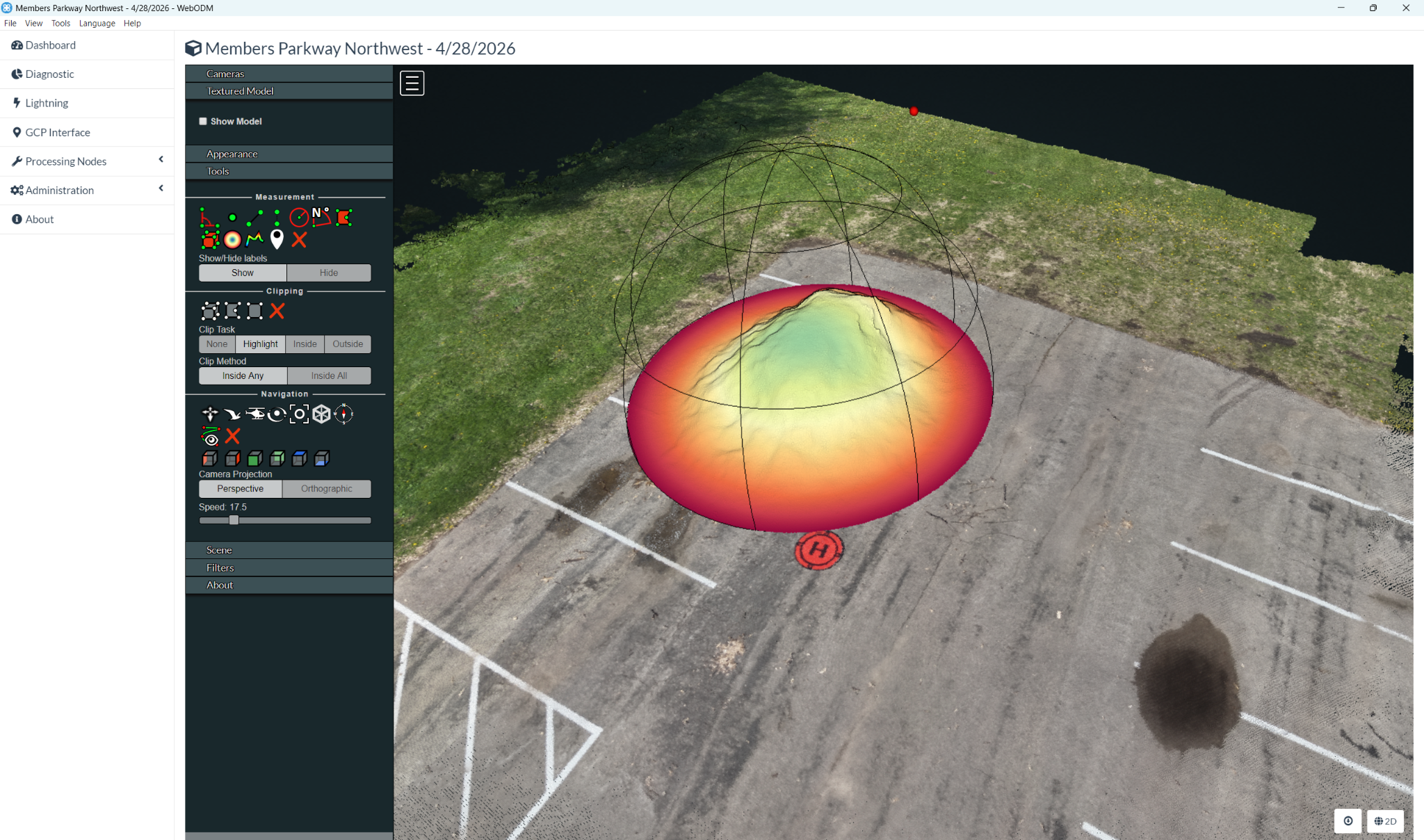
What we can help with
- Individual stockpile volume calculations
- Before-and-after reference measurements
- Supporting aerial and orthomosaic imagery
- Recurring measurement options
Final scope, deliverables, and schedule are confirmed with your quote.
Explore transparent pricing →Base Measurement — $400
Up to 1 acre and 4 stockpiles. Includes aerial photogrammetric capture, 3D surface/model processing, individual volume calculations, a volume summary, and supporting aerial/orthomosaic imagery.
Additional acreage: +$100 per acre. Additional stockpiles: +$25 each. Both charges apply when both conditions apply.
Calculated volumes are reference measurements, not certified survey quantities.
Technical Imaging supports documentation, visualization, measurement reference, and planning. It is not licensed surveying, engineering, certified inspection, or professional diagnosis. Read the full disclaimer →
LET’S TALK ABOUT YOUR PROJECT